Le Platin Forest
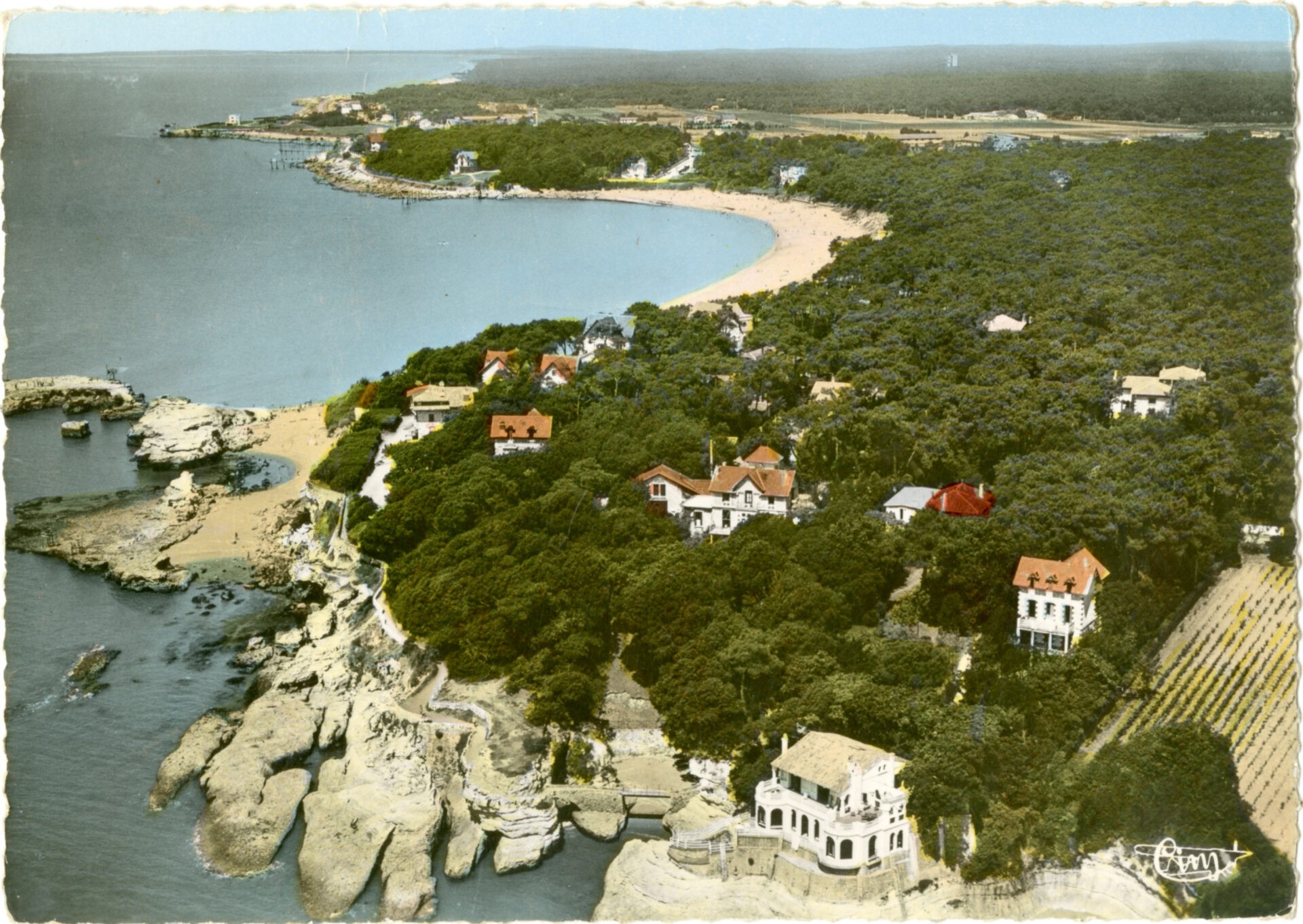
In the 18th century, with the sand advancing from Le Platin Cove, the dunes stretched all the way to the Rhâ Stream. These days, that space is covered by the market square and car parks. Aside from the absorption of farmland, the dunes also filled the Port of Saint-Palais-sur-Mer with sand.
From 1831 to 1837, Les Ponts et Chaussées (the French highways agency) planted pine there. Those trees went on to form what is now Le Platin Forest, which once extended to Bureau Cove.
Once the forest was established and the dunes held in place, the agency divided that vast nature area into 140 lots that were sold to private citizens between 1908 and 1914. The ones closest to Bureau Cove and along existing roads were quickly snatched up, primarily on the eastern side of Avenue de la République, and occupied by various businesses – the most famous of which was Café de Saint-Palais, now Le Dransard. Nothing was built on the other lots – near Le Platin Beach – until the 1970s and 1980s, for lack of an agreement between the owners on shared groundwork.
Le sentier des Douaniers
From the old customs house (Maison des Douanes) to Le Platin Cove, the Sentier des Douaniers is a coastal trail running above the rocks of Les Pierrières.
Beginning in the 18th century, that trail was used by customs officers to monitor the coastline. Given its interest as a remarkable nature area, the site of Les Pierrières the Minister Jean Zay issued a decree designating it as a listed nature site in 1938, in order to safeguard it against damage by humans.
Les Pierrières features the Grotte des Corsaires, or “privateers’ cave”. It was explored in 1986 and is one of the biggest caves in the Charente-Maritime department. It extends more than 300 metres in length. Entry to the cave is closed to the public to protect its fragile environment and also for safety reasons.
Bois du Roy boundary stones
In the wall surrounding the villa located at 3 Corniche des Pierrières, you can see a sculpted boundary stone with a naval anchor topped by the word “AMER” (daymark).
Mentioned as far back as the 18th century, the Bois du Roy (King’s Woods) covered around 20,000 m² of woods. It was planted with live oak and pine trees and overlooked the rocks of Les Pierrières. At the time, it belonged to the estate and private hunting ground of the Lord of Saint-Palais and served as a daymark, a visual landmark for ships travelling on the Gironde Estuary.
To protect the woods, the State acquired it in 1773, which is when it came to be known as the “King’s Woods”, and used stone markers to identify its boundaries. One of these is embedded in the wall around the villa called La Roche au Moine (“Monk’s Rock”). Another of these boundary stones can be found in the wall of Villa Mireille on Avenue de la Forêt.
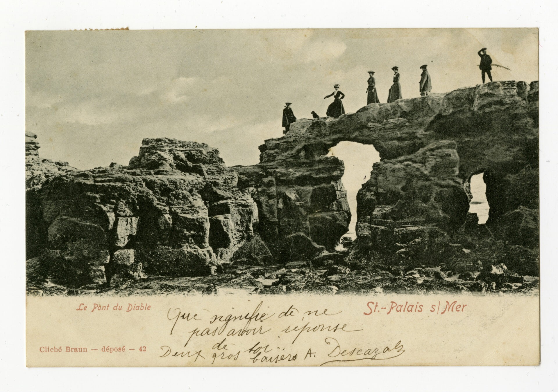
The Pont du Diable
The Pont du Diable (Devil’s Bridge) has been the source of many a legend. One of the legends claims that a fisherman whose boat was smashed against the rocks during a storm, called upon the saints, begging for his life, but instead, it was the devil who appeared before him. The devil then offered him a deal: he would save the fisherman in exchange for his soul.
The fisherman took the deal. The devil then told him to walk straight ahead. “You will get back to dry land when you cross the stone archway that I will build in front of you.” That archway is now known as the Pont du Diable.


